
Every Student Deserves to Be Recognized
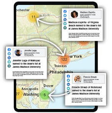
Merit’s software drives enrollment, increases donors, funding, and improves your institution’s visibility with targeted media placements of student success stories published and shared with parents, high schools, government reps and hometown media outlets.

a single unified platform

Personalized Student Stories
Press Release Distribution

Media
Monitoring
Erin is back, this time publishing an entire commencement story in under 4 minutes!
Merit is the best way to publish and distribute your commencement story, but don't take our word for it. Last year The University of Mississippi used Merit for the first time to publish their 2020 commencement story and received over 500,000 Facebook shares!


ERIN MARK | SENIOR STRATEGIST
Annual subscription
Unlimited use/users
No IT-integration required
100% FERPA / GDPR compliant
Dedicated Client Success Manager
Monday - Friday human support